
Articles | Volume 12, issue 2
https://doi.org/10.5194/soil-12-885-2026
© Author(s) 2026. This work is distributed under
the Creative Commons Attribution 4.0 License.
the Creative Commons Attribution 4.0 License.
https://doi.org/10.5194/soil-12-885-2026
© Author(s) 2026. This work is distributed under
the Creative Commons Attribution 4.0 License.
the Creative Commons Attribution 4.0 License.
Review article
| 
15 Sep 2026
Review article |
| 15 Sep 2026
| 15 Sep 2026
Post-disturbance soil monitoring in forests using remote sensing: an evidence map
Maisy Roach-Krajewski
Centre de foresterie des Laurentides, Ressources naturelles Canada, Québec, G1V 4C7, QC, Canada
Xavier Giroux-Bougard
Centre de foresterie des Laurentides, Ressources naturelles Canada, Québec, G1V 4C7, QC, Canada
David Paré
Centre de foresterie des Laurentides, Ressources naturelles Canada, Québec, G1V 4C7, QC, Canada
Catlan Dallaire
Pacific Forestry Centre, Natural Resources Canada, Victoria, V8Z 1M5, BC, Canada
Luc Guindon
Centre de foresterie des Laurentides, Ressources naturelles Canada, Québec, G1V 4C7, QC, Canada
Florian Jordan
Centre de foresterie des Laurentides, Ressources naturelles Canada, Québec, G1V 4C7, QC, Canada
Charlotte Norris
Pacific Forestry Centre, Natural Resources Canada, Victoria, V8Z 1M5, BC, Canada
Kara Webster
Great Lake Forestry Centre, Natural Resources Canada, Sault St. Marie, P6A 2E5, ON, Canada
Jérôme Laganière
CORRESPONDING AUTHOR

Centre de foresterie des Laurentides, Ressources naturelles Canada, Québec, G1V 4C7, QC, Canada
Related authors
No articles found.
Eunji Byun, Fereidoun Rezanezhad, Stephanie Slowinski, Christina Lam, Saraswati Bhusal, Stephanie Wright, William L. Quinton, Kara L. Webster, and Philippe Van Cappellen
SOIL, 11, 309–321, https://doi.org/10.5194/soil-11-309-2025, https://doi.org/10.5194/soil-11-309-2025, 2025
Short summary
Short summary
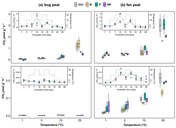
To investigate how added nutrient nitrogen (N) and phosphorus (P) affect subarctic peatlands, we sampled peat soils from bog and fen type peatlands in the Northwest Territories, Canada, and measured CO2 and CH4 production rates by means of laboratory incubations. Our short-term experiments show that changes in nutrient concentrations in soil water can significantly affect microbial carbon cycling, suggesting the necessity of additional considerations of wildfire and permafrost thaw impacts on peatland carbon storage.
Justine Lejoly, Sylvie Quideau, Jérôme Laganière, Justine Karst, Christine Martineau, Mathew Swallow, Charlotte Norris, and Abdul Samad
SOIL, 9, 461–478, https://doi.org/10.5194/soil-9-461-2023, https://doi.org/10.5194/soil-9-461-2023, 2023
Short summary
Short summary
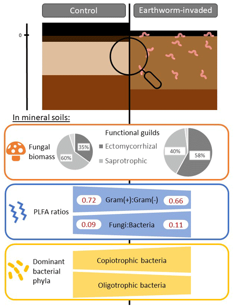
Earthworm invasion in North American forests can alter soil functioning. We investigated how the presence of invasive earthworms affected microbial communities, key drivers of soil biogeochemistry, across the major soil types of the Canadian boreal forest, which is a region largely understudied. Although total microbial biomass did not change, community composition shifted in earthworm-invaded mineral soils, where we also found higher fungal biomass and greater microbial species diversity.

David Paré, Jérôme Laganière, Guy R. Larocque, and Robert Boutin
SOIL, 8, 673–686, https://doi.org/10.5194/soil-8-673-2022, https://doi.org/10.5194/soil-8-673-2022, 2022
Short summary
Short summary
Major soil carbon pools and fluxes were assessed along a climatic gradient expanding 4 °C in mean annual temperature for two important boreal conifer forest stand types. Species and a warmer climate affected soil organic matter (SOM) cycling but not stocks. Contrarily to common hypotheses, SOM lability was not reduced by warmer climatic conditions and perhaps increased. Results apply to cold and wet conditions and a stable vegetation composition along the climate gradient.
Cited articles
Affek, A. N., Zachwatowicz, M., Sosnowska, A., Gerlée, A., and Kiszka, K.: Impacts of modern mechanised skidding on the natural and cultural heritage of the Polish Carpathian Mountains, Forest Ecol. Manage., 405, 391–403, https://doi.org/10.1016/j.foreco.2017.09.047, 2017.
Agbeshie, A. A., Abugre, S., Atta-Darkwa, T., and Awuah, R.: A review of the effects of forest fire on soil properties, J. Forest Res., 33, 1419–1441, https://doi.org/10.1007/s11676-022-01475-4, 2022.
Allen, J. L. and Sorbel, B.: Assessing the differenced Normalized Burn Ratio's ability to map burn severity in the boreal forest and tundra ecosystems of Alaska's national parks, Int. J. Wildland Fire, 17, 463–475, https://doi.org/10.1071/WF08034, 2008.
Baur, M. J., Friend, A. D., and Pellegrini, A. F. A.: Widespread and systematic effects of fire on plant–soil water relations, Nat. Geosci., 17, https://doi.org/10.1038/s41561-024-01563-6, 2024.
Beltrán-Marcos, D., Suárez-Seoane, S., Fernández-Guisuraga, J. M., Fernández-García, V., Pinto, R., García-Llamas, P., and Calvo, L.: Mapping soil burn severity at very high spatial resolution from unmanned aerial vehicles, Forests, 12, 179, https://doi.org/10.3390/f12020179, 2021.
Beltrán-Marcos, D., Suárez-Seoane, S., Fernández-Guisuraga, J. M., Fernández-García, V., Marcos, E., and Calvo, L.: Relevance of UAV and Sentinel-2 data fusion for estimating topsoil organic carbon after forest fire, Geoderma, 430, 116290, https://doi.org/10.1016/j.geoderma.2022.116290, 2023.
Bhatnagar, S., Puliti, S., Talbot, B., Heppelmann, J. B., Breidenbach, J., and Astrup, R.: Mapping wheel-ruts from timber harvesting operations using deep learning techniques in drone imagery, Forestry, cpac023, https://doi.org/10.1093/forestry/cpac023, 2022.
Bonan, G. B.: Forests and Climate Change: Forcings, Feedbacks, and the Climate Benefits of Forests, Science, 320, 1444–1449, https://doi.org/10.1126/science.1155121, 2008.
Borsah, A. A., Nazeer, M., and Wong, M. S.: LIDAR-Based Forest Biomass Remote Sensing: A Review of Metrics, Methods, and Assessment Criteria for the Selection of Allometric Equations, Forests, 14, 2095, https://doi.org/10.3390/f14102095, 2023.
Bourgeau-Chavez, L. L., Kasischke, E. S., Riordan, K., Brunzell, S., Nolan, M., Hyer, E., Slawski, J., Medvecz, M., Walters, T., and Ames, S.: Remote monitoring of spatial and temporal surface soil moisture in fire disturbed boreal forest ecosystems with ERS SAR imagery, Int. J. Remote Sens., 28, 2133–2162, https://doi.org/10.1080/01431160600976061, 2007.
Bowd, E. J., Banks, S. C., Strong, C. L., and Lindenmayer, D. B.: Long-term impacts of wildfire and logging on forest soils, Nat. Geosci., 12, 113–118, https://doi.org/10.1038/s41561-018-0294-2, 2019.
Brown, K. J., Metsaranta, J., Paré, D., Perrakis, D. D., Van Der Kamp, D., Webster, K. L., Whitman, E., Arsenault, A., Dranga, S., Harvey, J. E., and Laganière, J.: Examining post-fire environmental change and succession in Canada, Environ. Rev., https://doi.org/10.1139/er-2025-0224, 2026.
Bryan, J.: googlesheets4: Access Google Sheets using the Sheets API V4, R package version 1.1.2, https://googlesheets4.tidyverse.org (last access: 26 March 2026), 2025.
Cambi, M., Certini, G., Neri, F., and Marchi, E.: The impact of heavy traffic on forest soils: A review, Forest Ecol. Manage., 338, 124–138. https://doi.org/10.1016/j.foreco.2014.11.022, 2015.
Cambi, M., Giannetti, F., Bottalico, F., Travaglini, D., Nordfjell, T., Chirici, G., and Marchi, E.: Estimating machine impact on strip roads via close-range photogrammetry and soil parameters: A case study in central Italy, iForest 11, 148–154, https://doi.org/10.3832/ifor2590-010, 2018.
Campbell, D. M. H., White, B., and Arp, P. A.: Modeling and mapping soil resistance to penetration and rutting using LiDAR-derived digital elevation data, J. Soil Water Conserv., 68, 460–473, https://doi.org/10.2489/jswc.68.6.460, 2013.
Chafer, C. J.: A comparison of fire severity measures: An Australian example and implications for predicting major areas of soil erosion, CATENA, 74, 235–245, https://doi.org/10.1016/j.catena.2007.12.005, 2008.
Chasmer, L. E., Hopkinson, C. D., Petrone, R. M., and Sitar, M.: Using multitemporal and multispectral airborne lidar to assess depth of peat loss and correspondence with a new Active Normalized Burn Ratio for wildfires, Geophys. Res. Lett., 44, 11851–11859, https://doi.org/10.1002/2017GL075488, 2017.
Chen, Y., Morton, D. C., and Randerson, J. T.: Remote sensing for wildfire monitoring: Insights into burned area, emissions, and fire dynamics, One Earth, 7, 1022–1028, https://doi.org/10.1016/j.oneear.2024.05.014, 2024.
Conrad-Rooney, E., Barker Plotkin, A., Pasquarella, V. J., Elkinton, J., Chandler, J. L., and Matthes, J. H.: Defoliation severity is positively related to soil solution nitrogen availability and negatively related to soil nitrogen concentrations following a multi-year invasive insect irruption, AoB PLANTS, 12, plaa059, https://doi.org/10.1093/aobpla/plaa059, 2020.
Cook, C. N., Nichols, S. J., Webb, J. A., Fuller, R. A., and Richards, R. M.: Simplifying the selection of evidence synthesis methods to inform environmental decisions: A guide for decision makers and scientists, Biol. Conserv., 213, 135–145, https://doi.org/10.1016/j.biocon.2017.07.004, 2017.
Dąbek, P. B., Żmuda, R., Szczepański, J., and Ćmielewski, B.: Evaluation of water soil erosion processes in forest areas in the Western Sudetes using terrestrial laser scanning and GIS tools, E3S Web of Conferences, 44, 00026, https://doi.org/10.1051/e3sconf/20184400026, 2018.
DeArmond, D., Ferraz, J. B. S., and Higuchi, N.: Natural recovery of skid trails: a review, Can. J. Forest Res., 51, 948–961, https://doi.org/10.1139/cjfr-2020-0419, 2021.
Delgado-Baquerizo, M., Eldridge, D. J., Liu, Y.-R., Liu, Z.-W., Coleine, C., and Trivedi, P.: Soil biodiversity and function under global change, PLoS Biol., 23, e3003093, https://doi.org/10.1371/journal.pbio.3003093, 2025.
Deligiannakis, G., Pallikarakis, A., Papanikolaou, I., Alexiou, S., and Reicherter, K.: Detecting and monitoring early post-fire sliding phenomena using UAV–SfM photogrammetry and t-LiDAR-derived point clouds, Fire, 4, 87, https://doi.org/10.3390/fire4040087, 2021.
DeVries, B., Verbesselt, J., Kooistra, L., and Herold, M.: Robust monitoring of small-scale forest disturbances in a tropical montane forest using Landsat time series, Remote Sens. Environ., 161, 107–121, https://doi.org/10.1016/j.rse.2015.02.012, 2015.
Dinerstein, E., Olson, D., Joshi, A., Vynne, C., Burgess, N. D., Wikramanayake, E., Hahn, N., Palminteri, S., Hedao, P., Noss, R., Hansen, M., Locke, H., Ellis, E. C., Jones, B., Barber, C. V., Hayes, R., Kormos, C., Martin, V., Crist, E., Sechrest, W., Price, L., Baillie, J. E. M., Weeden, D., Suckling, K., Davis, C., Sizer, N., Moore, R., Thau, D., Birch, T., Potapov, P., Turubanova, S., Tyukavina, A., De Souza, N., Pintea, L., Brito, J. C., Llewellyn, O. A., Miller, A. G., Patzelt, A., Ghazanfar, S. A., Timberlake, J., Klöser, H., Shennan-Farpón, Y., Kindt, R., Lillesø, J.-P. B., Van Breugel, P., Graudal, L., Voge, M., Al-Shammari, K. F., and Saleem, M.: An ecoregion-based approach to protecting half the terrestrial realm, BioScience 67, 534–545, https://doi.org/10.1093/biosci/bix014, 2017.
Doerr, S. H., Shakesby, R. A., Blake, W. H., Chafer, C. J., Humphreys, G. S., and Wallbrink, P.: Effects of differing wildfire severities on soil wettability and implications for hydrological response, J. Hydrol., 319, 295–311, https://doi.org/10.1016/j.jhydrol.2005.06.038, 2006.
Dubé, S. and Berch, S.: Monitoring soil disturbance on salvaged areas within the mountain pine beetle infestation using digital imagery, J. Appl. Remote Sens., 7, 073541, https://doi.org/10.1117/1.JRS.7.073541, 2013.
Dupuis, C., Lejeune, P., Michez, A., and Fayolle, A.: How Can Remote Sensing Help Monitor Tropical Moist Forest Degradation? – A Systematic Review, Remote Sens., 12, 1087, https://doi.org/10.3390/rs12071087, 2020.
Essbiti, M. C., Namous, M., Krimissa, S., Elaloui, A., Hajaj, S., Mosaid, H., Ismaili, M., Hajji, S., El Atiq, J., and El Kamouni, F. E.: Emerging trends and future directions in remote-sensing techniques and platforms for sustainable forest degradation monitoring: a review, Med. Geosc. Rev., 7, 953–976, https://doi.org/10.1007/s42990-025-00184-4, 2025.
FAO: Status of the World's Soil Resources 2025, Food and Agriculture Organization of the United Nations, Rome, Italy, https://openknowledge.fao.org/handle/20.500.14283/i5199e (last access: 8 September 2026), 2025
Fassnacht, F. E., White, J. C., Wulder, M. A., and Næsset, E.: Remote sensing in forestry: current challenges, considerations and directions. Forestry, 97, 11–37, https://doi.org/10.1093/forestry/cpad024, 2024.
Ferenčík, M., Dudáková, Z., Kardoš, M., Sivák, M., Merganičová, K., and Merganič, J.: Measuring soil surface changes after traffic of various wheeled skidders with close-range photogrammetry, Forests, 13, 976, https://doi.org/10.3390/f13070976, 2022.
Fernández, C., Fernández-Alonso, J. M., Vega, J. A., Fontúrbel, T., Llorens, R., and Sobrino, J. A.: Exploring the use of spectral indices to assess alterations in soil properties in pine stands affected by crown fire in Spain, Fire Ecol., 17, 2, https://doi.org/10.1186/s42408-020-00089-7, 2021.
Fernández-García, V., Santamarta, M., Fernández-Manso, A., Quintano, C., Marcos, E., and Calvo, L.: Burn severity metrics in fire-prone pine ecosystems along a climatic gradient using Landsat imagery, Remote Sens. Environ., 206, 205–217, https://doi.org/10.1016/j.rse.2017.12.029, 2018.
Fernández-Guisuraga, J. M., Marcos, E., Suárez-Seoane, S., and Calvo, L.: ALOS-2 L-band SAR backscatter data improves the estimation and temporal transferability of wildfire effects on soil properties under different post-fire vegetation responses, Sci. Total Environ., 842, 156852, https://doi.org/10.1016/j.scitotenv.2022.156852, 2022.
Flores-Anderson, A. I., Cardille, J., Azad, K., Cherrington, E., Zhang, Y., and Wilson, S.: Spatial and Temporal Availability of Cloud-free Optical Observations in the Tropics to Monitor Deforestation, Sci. Data, 10, 550, https://doi.org/10.1038/s41597-023-02439-x, 2023.
Fraser, R., Van Der Sluijs, J., and Hall, R.: Calibrating Satellite-Based Indices of Burn Severity from UAV-Derived Metrics of a Burned Boreal Forest in NWT, Canada, Remote Sensing, 9, 279, https://doi.org/10.3390/rs9030279, 2017.
French, N. H. F., Kasischke, E. S., Bourgeau-Chavez, L. L., and Harrell, P. A.: Sensitivity of ERS-1 SAR to variations in soil water in fire-disturbed boreal forest ecosystems, Int. J. Remote Sens., 17, 3037–3053, https://doi.org/10.1080/01431169608949126, 1996.
Gao, Y., Skutsch, M., Paneque-Gálvez, J., and Ghilardi, A.: Remote sensing of forest degradation: a review, Environ. Res. Lett., 15, 103001, https://doi.org/10.1088/1748-9326/abaad7, 2020.
Ge, Y., Thomasson, J. A., and Sui, R.: Remote sensing of soil properties in precision agriculture: A review, Front. Earth Sci., https://doi.org/10.1007/s11707-011-0175-0, 2011.
Giannetti, F., Chirici, G., Travaglini, D., Bottalico, F., Marchi, E., and Cambi, M.: Assessment of soil disturbance caused by forest operations by means of portable laser scanner and soil physical parameters, Soil Sci. Soc. Am. J., 81, 1577–1585, https://doi.org/10.2136/sssaj2017.02.0051, 2017.
Godziek, J.: Root plates of uprooted trees – Automatic detection and biotransport estimation using LiDAR data and field mapping, Int. J. Appl. Earth Obs., 131, 103992, https://doi.org/10.1016/j.jag.2024.103992, 2024.
Guilinger, J. J., Foufoula-Georgiou, E., Gray, A. B., Randerson, J. T., Smyth, P., Barth, N. C., and Goulden, M. L.: Predicting postfire sediment yields of small steep catchments using airborne lidar differencing, Geophys. Res. Lett., 50, e2023GL104626, https://doi.org/10.1029/2023GL104626, 2023.
Guindon, L., Gauthier, S., Manka, F., Parisien, M.-A., Whitman, E., Bernier, P., Beaudoin, A., Villemaire, P., and Skakun, R.: Trends in wildfire burn severity across Canada, 1985 to 2015, Can. J. Forest Res., 51, 1230–1244, https://doi.org/10.1139/cjfr-2020-0353, 2021.
Haas, J., Hagge Ellhöft, K., Schack-Kirchner, H., and Lang, F.: Using photogrammetry to assess rutting caused by a forwarder – A comparison of different tires and bogie tracks, Soil Till. Res., 163, 14–20, https://doi.org/10.1016/j.still.2016.04.008, 2016.
Haddaway, N., Macura, B., Whaley, P., and Pullin, A.: ROSES flow diagram for systematic maps, Version 1.0, figshare, https://doi.org/10.6084/M9.FIGSHARE.6085940, 2018.
Harzing, A. W.: Publish or perish, https://harzing.com/resources/publish-or-perish (last access: 26 February 2025), 2007.
Heppelmann, J. B., Talbot, B., Antón Fernández, C., and Astrup, R.: Depth-to-water maps as predictors of rut severity in fully mechanized harvesting operations, International Journal of Forest Engineering, 33, 108–118, https://doi.org/10.1080/14942119.2022.2044724, 2022.
Howari, F.: AI–Remote Sensing for Soil Variability Mapping and Precision Agrochemical Management: A Comprehensive Review of Methods, Limitations, and Climate-Smart Applications, Agrochemicals, 5, 1, https://doi.org/10.3390/agrochemicals5010001, 2025.
Hoy, E. E., French, N. H. F., Turetsky, M. R., Trigg, S. N., and Kasischke, E. S.: Evaluating the potential of Landsat TM/ETM+ imagery for assessing fire severity in Alaskan black spruce forests, Int. J. Wildland Fire, 17, 500–514, https://doi.org/10.1071/WF08107, 2008.
Hudak, A., Robichaud, P. R., Jain, T., Morgan, P., Stone, C., and Clark, J.: The relationship of field burn severity measures to satellite-derived Burned Area Reflectance Classification (BARC) maps, American Society of Photogrammetry and Remote Sensing Conference Proceedings, https://research.fs.usda.gov/treesearch/26195 (last access: 20 March 2025), 2004a.
Hudak, A. T., Robichaud, P. R., Evans, J. S., Clark, J., Lannom, K., Morgan, P., and Stone, C.: Field validation of Burned Area Reflectance Classification (BARC) products for post fire assessment, in: Remote Sensing for Field Users: Proceedings of the Tenth Forest Service Remote Sensing Applications Conference, edited by: Greer, J. D., Salt Lake City, Utah, 5–9 April 2004, American Society for Photogrammetry and Remote Sensing, Bethesda, Maryland, https://research.fs.usda.gov/treesearch/23530 (last access: 20 March 2025), 2004b.
Hudak, A. T., Morgan, P., Bobbitt, M. J., Smith, A. M. S., Lewis, S. A., Lentile, L. B., Robichaud, P. R., Clark, J. T., and McKinley, R. A.: The relationship of multispectral satellite imagery to immediate fire effects, Fire Ecol., 3, 64–90, https://doi.org/10.4996/fireecology.0301064, 2007.
Jordan, F., Paré, D., Norris, C., Webster, K., Dallaire, C., and Laganière, J.: Understanding Forest Soil Degradation in Canada: Threats, Indicators, and Knowledge Gaps, SSRN [preprint], https://doi.org/10.2139/ssrn.7265238, 31 July 2026.
Kadakci Koca, T.: A statistical approach to site-specific thresholding for burn severity maps using bi-temporal Landsat-8 images, Earth Sci. Inform., 16, 1313–1327, https://doi.org/10.1007/s12145-023-00980-2, 2023.
Kadakci Koca, T., Küçükuysal, C., Gül, M., and Esetlili, T.: A comprehensive approach to soil burn severity mapping for erosion susceptibility assessment, Catena, 245, 108302, https://doi.org/10.1016/j.catena.2024.108302, 2024.
Key, C. H. and Benson, N. C.: Landscape Assessment (LA), in: FIREMON: Fire effects monitoring and inventory system, edited by: Lutes, D. C., Keane, R. E., Caratti, J. F., Key, C. H., Benson, N. C., Sutherland, S., and Gangi, L. J., Gen. Tech. Rep. RMRS-GTR-164-CD, U.S. Department of Agriculture, Forest Service, Rocky Mountain Research Station, Fort Collins, CO, LA-1–LA-55, https://research.fs.usda.gov/treesearch/24066 (last access: 8 September 2026), 2006.
Kim, I., Seo, J., Woo, H., and Choi, B.: Assessing rutting and soil compaction caused by wood extraction using traditional and remote sensing methods, Forests, 16, 86, https://doi.org/10.3390/f16010086, 2025.
Kim, J., Kim, I., Ha, E., and Choi, B.: UAV photogrammetry for soil surface deformation detection in a timber harvesting area, South Korea, Forests, 14, 980, https://doi.org/10.3390/f14050980, 2023.
Kokaly, R. F., Rockwell, B. W., Haire, S. L., and King, T. V. V.: Characterization of post-fire surface cover, soils, and burn severity at the Cerro Grande Fire, New Mexico, using hyperspectral and multispectral remote sensing, Remote Sens. Environ., 106, 305–325, https://doi.org/10.1016/j.rse.2006.08.006, 2007.
Koren, M., Slančík, M., Suchomel, J., and Dubina, J.: Use of terrestrial laser scanning to evaluate the spatial distribution of soil disturbance by skidding operations, iForest, 8, 386–393, https://doi.org/10.3832/ifor1165-007, 2015.
Kubiak, K., Spiralski, M., Pompeu, J., Levavasseur, V., and Wawer, R.: Advances in Remote Sensing for Monitoring Soil Conditions in Forest Ecosystems: Techniques, Challenges, and Applications, Transactions on Aerospace Research, 2024, 1–13, https://doi.org/10.2478/tar-2024-0019, 2024.
Latterini, F., Venanzi, R., Tocci, D., Moschetti, F., and Picchio, R.: Comparing accuracy of three remote sensing methods to evaluate soil impact related to forest operations, in: The 1st International Electronic Conference on Forests; Forests for a Better Future: Sustainability, Innovation, Interdisciplinarity, International Electronic Conference on Forests, MDPI, p. 59, https://doi.org/10.3390/IECF2020-07954, 2020.
Latterini, F., Camarretta, N., and Watt, M. S.: Remote sensing for planning harvesting operations and monitoring their effects on the forest ecosystem: State of the art and future perspectives, Forest Ecol. Manage., 597, 123175, https://doi.org/10.1016/j.foreco.2025.123175, 2025.
Lausch, A., Erasmi, S., King, D., Magdon, P., and Heurich, M.: Understanding Forest Health with Remote Sensing – Part I – A Review of Spectral Traits, Processes and Remote-Sensing Characteristics, Remote Sens., 8, 1029, https://doi.org/10.3390/rs8121029, 2016.
Lee, K., Elliott, S., and Tiansawat, P.: Use of drone RGB imagery to quantify indicator variables of tropical-forest-ecosystem degradation and restoration, Forests, 14, 586, https://doi.org/10.3390/f14030586, 2023.
Lewis, S. A., Robichaud, P. R., Elliot, W. J., Frazier, B. E., and Wu, J. Q.: Hyperspectral remote sensing of postfire soil properties. In: Proceedings of the Tenth Biennial USDA Forest Service Remote Sensing Applications Conference, Salt Lake City, Utah, 5–9 April 2004, https://research.fs.usda.gov/treesearch/23527 (last access: 20 March 2025), 2004.
Lewis, S. A., Hudak, A. T., Ottmar, R. D., Robichaud, P. R., Lentile, L. B., Hood, S. M., Cronan, J. B., and Morgan, P.: Using hyperspectral imagery to estimate forest floor consumption from wildfire in boreal forests of Alaska, USA, Int. J. Wildland Fire, 20, 255, https://doi.org/10.1071/WF09081, 2011.
Lewis, S. A., Hudak, A. T., Robichaud, P. R., Morgan, P., Satterberg, K. L., Strand, E. K., Smith, A. M. S., Zamudio, J. A., and Lentile, L. B.: Indicators of burn severity at extended temporal scales: A decade of ecosystem response in mixed-conifer forests of western Montana, Int. J. Wildland Fire, 26, 755, https://doi.org/10.1071/WF17019, 2017.
Lewis, S. A., Robichaud, P. R., Archer, V. A., Hudak, A. T., Eitel, J. U. H., and Strand, E. K.: Informing sustainable forest management: Remote sensing strategies for assessing soil disturbance after wildfire and salvage logging, Forests, 14, 2218, https://doi.org/10.3390/f14112218, 2023.
Lewis, S. A., Robichaud, P. R., Hudak, A. T., Austin, B., and Liebermann, R. J.: Utility of remotely sensed imagery for assessing the impact of salvage logging after forest fires, Remote Sens., 4, 2112–2132, https://doi.org/10.3390/rs4072112, 2012.
Llorens, R., Sobrino, J. A., Fernández, C., Fernández-Alonso, J. M., and Vega, J. A.: Soil burn severity assessment using Sentinel-2 and radiometric measurements, Fire, 7, 487, https://doi.org/10.3390/fire7120487, 2024.
Mallinis, G., Maris, F., Kalinderis, I., and Koutsias, N.: Assessment of post-fire soil erosion risk in fire-affected watersheds using remote sensing and GIS, GISci. Remote Sens., 46, 388–410, https://doi.org/10.2747/1548-1603.46.4.388, 2009.
Marcos, E., Fernández-García, V., Fernández-Manso, A., Quintano, C., Valbuena, L., Tárrega, R., Luis-Calabuig, E., and Calvo, L.: Evaluation of Composite Burn Index and Land Surface Temperature for Assessing Soil Burn Severity in Mediterranean Fire-Prone Pine Ecosystems, Forests, 9, 494, https://doi.org/10.3390/f9080494, 2018.
Marquínez, J., Wozniak, E., Fernández, S., and Martínez, R.: Analysis of the evolution of soil erosion classes using multitemporal Landsat imagery, Int. J. Wildland Fire, 17, 549–558, https://doi.org/10.1071/WF06138, 2008.
Marra, E., Cambi, M., Fernandez-Lacruz, R., Giannetti, F., Marchi, E., and Nordfjell, T.: Photogrammetric estimation of wheel rut dimensions and soil compaction after increasing numbers of forwarder passes, Scand. J. Forest Res., 33, 613–620, https://doi.org/10.1080/02827581.2018.1427789, 2018.
Marra, E., Wictorsson, R., Bohlin, J., Marchi, E., and Nordfjell, T.: Remote measuring of the depth of wheel ruts in forest terrain using a drone, International Journal of Forest Engineering, 32, 224–234, https://doi.org/10.1080/14942119.2021.1916228, 2021.
Marra, E., Laschi, A., Fabiano, F., Foderi, C., Neri, F., Mastrolonardo, G., Nordfjell, T., and Marchi, E.: Impacts of wood extraction on soil: Assessing rutting and soil compaction caused by skidding and forwarding by means of traditional and innovative methods, Eur. J. Forest Res., 141, 71–86, https://doi.org/10.1007/s10342-021-01420-w, 2022.
Massicotte, P.: rnaturalearth: World Map Data from Natural Earth, R package, https://doi.org/10.32614/CRAN.package.rnaturalearth, 2025.
Maurya, S., Abraham, J. S., Somasundaram, S., Toteja, R., Gupta, R., and Makhija, S.: Indicators for assessment of soil quality: a mini-review, Environ. Monit. Assess., 192, 604, https://doi.org/10.1007/s10661-020-08556-z, 2020.
McNeil, B. E., de Beurs, K. M., Eshleman, K. N., Foster, J. R., and Townsend, P. A.: Maintenance of ecosystem nitrogen limitation by ephemeral forest disturbance: An assessment using MODIS, Hyperion, and Landsat ETM+, Geophys. Res. Lett., 34, L19406, https://doi.org/10.1029/2007GL031387, 2007.
Melaas, E. K., Sulla-Menashe, D., Gray, J. M., Black, T. A., Morin, T. H., Richardson, A. D., and Friedl, M. A.: Multisite analysis of land surface phenology in North American temperate and boreal deciduous forests from Landsat, Remote Sens. Environ., 186, 452–464, https://doi.org/10.1016/j.rse.2016.09.014, 2016.
Melander, L. and Ritala, R.: Time-of-flight imaging for assessing soil deformations and improving forestry vehicle tracking accuracy, International Journal of Forest Engineering, 29, 14–24, https://doi.org/10.1080/14942119.2018.1421341, 2018.
Melendy, L., Hagen, S. C., Sullivan, F. B., Pearson, T. R. H., Walker, S. M., Ellis, P., Kustiyo, K., Sambodo, A. K., Roswintiarti, O., Hanson, M. A., Klassen, A. W., Palace, M. W., Braswell, B. H., and Delgado, G. M.: Automated method for measuring the extent of selective logging damage with airborne LiDAR data, ISPRS J. Photogramm., 139, 228–240, https://doi.org/10.1016/j.isprsjprs.2018.02.022, 2018.
Mesa-Mingorance, J. L. and Ariza-López, F. J.: Accuracy Assessment of Digital Elevation Models (DEMs): A Critical Review of Practices of the Past Three Decades, Remote Sensing, 12, 2630, https://doi.org/10.3390/rs12162630, 2020.
Mohieddinne, H., Brasseur, B., Gallet-Moron, E., Lenoir, J., Spicher, F., Kobaissi, A., and Horen, H.: Assessment of soil compaction and rutting in managed forests through an airborne LiDAR technique, Land Degrad. Dev., 34, 1558–1569, https://doi.org/10.1002/ldr.4553, 2022.
Mohieddinne, H., Brasseur, B., Spicher, F., Gallet-Moron, E., Buridant, J., Kobaissi, A., and Horen, H.: Physical recovery of forest soil after compaction by heavy machines, revealed by penetration resistance over multiple decades, Forest Ecol. Manage., 449, 117472, https://doi.org/10.1016/j.foreco.2019.117472, 2019.
Moody, J. A., Shakesby, R. A., Robichaud, P. R., Cannon, S. H., and Martin, D. A.: Current research issues related to post-wildfire runoff and erosion processes, Earth-Sci. Rev., 122, 10–37, https://doi.org/10.1016/j.earscirev.2013.03.004, 2013.
Morgan, P., Keane, R. E., Dillon, G. K., Jain, T. B., Hudak, A. T., Karau, E. C., Sikkink, P. G., Holden, Z. A., and Strand, E. K.: Challenges of assessing fire and burn severity using field measures, remote sensing and modelling, Int. J. Wildland Fire, 23, 1045, https://doi.org/10.1071/WF13058, 2014.
NASA Earth Science Technology Office: ESTO annual report 2024, National Aeronautics and Space Administration, Washington, D.C., USA, https://esto.nasa.gov/2024-esto-annual-report/ (last access: 8 September 2026), 2024.
Nevalainen, P., Salmivaara, A., Ala-Ilomäki, J., Launiainen, S., Hiedanpää, J., Finér, L., Pahikkala, T., and Heikkonen, J.: Estimating the rut depth by UAV photogrammetry, Remote Sens., 9, 1279, https://doi.org/10.3390/rs9121279, 2017.
Niemi, M. T., Vastaranta, M., Vauhkonen, J., Melkas, T., and Holopainen, M.: Airborne LiDAR-derived elevation data in terrain trafficability mapping, Scand. J. Forest Res., 32, 762–773, https://doi.org/10.1080/02827581.2017.1296181, 2017.
Paré, D., Bognounou, F., Emilson, E. J. S., Laganière, J., Leach, J., Mansuy, N., Martineau, C., Norris, C., Venier, L., and Webster, K.: Connecting forest soil properties with ecosystem services: Toward a better use of digital soil maps – A review, Soil Sci. Soc. Am. J., 88, 981–999, https://doi.org/10.1002/saj2.20705, 2024.
Pastore, M. A., Lang, A. K., Shaw, J. D., Cahoon, S. M. P., Peter-Contesse, H., Owen, S. M., Morin, R. S., Knott, J. A., Domke, G. M., Esham, B., and Berryman, E. M.: Beneath the surface: A 25-year review of soil monitoring in the U.S. Forest Inventory and Analysis program, Forest Ecol. Manage., 595, 123023, https://doi.org/10.1016/j.foreco.2025.123023, 2025.
Pebesma, E.: Simple Features for R: Standardized Support for Spatial Vector Data, R J., 10, 439–446, 2018.
Pellegrini, A. F. A., Harden, J., Georgiou, K., Hemes, K. S., Malhotra, A., Nolan, C. J., and Jackson, R. B.: Fire effects on the persistence of soil organic matter and long-term carbon storage, Nat. Geosci., 15, 5–13, https://doi.org/10.1038/s41561-021-00867-1, 2021.
Perbet, P., Guindon, L., Côté, J.-F., and Béland, M.: Evaluating landsat time series of above-ground biomass to monitor boreal forest recovery following different types of disturbance, Can. J. Remote Sens., 51, 2587489, https://doi.org/10.1080/07038992.2025.2587489, 2025.
Pierzchała, M., Talbot, B., and Astrup, R.: Estimating soil displacement from timber extraction trails in steep terrain: Application of an unmanned aircraft for 3D modelling, Forests, 5, 1212–1223, https://doi.org/10.3390/f5061212, 2014.
Pierzchała, M., Talbot, B., and Astrup, R.: Measuring wheel ruts with close-range photogrammetry, Forestry, 89, 383–391, https://doi.org/10.1093/forestry/cpw009, 2016.
Pohjankukka, J., Riihimäki, H., Nevalainen, P., Pahikkala, T., Ala-Ilomäki, J., Hyvönen, E., Varjo, J., and Heikkonen, J.: Predictability of boreal forest soil bearing capacity by machine learning, J. Terramechanics, 68, 1–8, https://doi.org/10.1016/j.jterra.2016.09.001, 2016.
Puliti, S., Saarela, S., Gobakken, T., Ståhl, G., and Næsset, E.: Combining UAV and Sentinel-2 auxiliary data for forest growing stock volume estimation through hierarchical model-based inference, Remote Sens. Environ., 204, 485–497, https://doi.org/10.1016/j.rse.2017.10.007, 2018.
Pullin, A. S., Frampton, G. K., Livoreil, B., and Petrokofsky, G. (Eds.): Guidelines and Standards for Evidence Synthesis in Environmental Management, Version 5.1, Collaboration for Environmental Evidence, https://environmentalevidence.org/information-for-authors/ (last access: 8 September 2026), 2022.
Quintano, C., Fernández-Manso, A., Calvo, L., and Roberts, D. A.: Vegetation and Soil Fire Damage Analysis Based on Species Distribution Modeling Trained with Multispectral Satellite Data, Remote Sens., 11, 1832, https://doi.org/10.3390/rs11151832, 2019.
R Core Team: R: A Language and Environment for Statistical Computing, R Foundation for Statistical Computing, Vienna, Austria, https://www.R-project.org/ (last access: 8 September 2026), 2024.
Rengers, F. K., Tucker, G. E., Moody, J. A., and Ebel, B. A.: Illuminating wildfire erosion and deposition patterns with repeat terrestrial LiDAR, J. Geophys. Res.-Earth, 121, 588–608, https://doi.org/10.1002/2015JF003600, 2016.
Roach-Krajewski, M., Giroux-Bougard, X., Paré, D., Dallaire, C., Guindon, L., Jordan, F., Norris, C., Webster, K., and Laganière, J.: Post-Disturbance Soil Monitoring in Forests using Remote Sensing: An Evidence Map, Zenodo [code, data set], https://doi.org/10.5281/zenodo.19225706, 2026.
Robichaud, P. R., Lewis, S. A., Laes, D. Y. M., Hudak, A. T., Kokaly, R. F., and Zamudio, J. A.: Postfire soil burn severity mapping with hyperspectral image unmixing, Remote Sens. Environ., 108, 467–480, https://doi.org/10.1016/j.rse.2006.11.027, 2007.
Robichaud, P. R., Lewis, S. A., Brown, R. E., Bone, E. D., and Brooks, E. S.: Evaluating post-wildfire logging-slash cover treatment to reduce hillslope erosion after salvage logging using ground measurements and remote sensing, Hydrol. Process., 34, 4431–4445, https://doi.org/10.1002/hyp.13882, 2020.
Rogan, J. and Franklin, J.: Mapping wildfire burn severity in Southern California forests and shrublands using Enhanced Thematic Mapper imagery, Geocarto Int., 16, 91–106, https://doi.org/10.1080/10106040108542218, 2001.
Rose, M. B. and Nagle, N. N.: Characterizing Forest Dynamics with Landsat-Derived Phenology Curves, Remote Sens., 13, 267, https://doi.org/10.3390/rs13020267, 2021.
Salmivaara, A., Miettinen, M., Finér, L., Launiainen, S., Korpunen, H., Tuominen, S., Heikkonen, J., Nevalainen, P., Sirén, M., Ala-Ilomäki, J., and Uusitalo, J.: Wheel rut measurements by forest machine-mounted LiDAR sensors: Accuracy and potential for operational applications?, International Journal of Forest Engineering, 29, 41–52, https://doi.org/10.1080/14942119.2018.1419677, 2018.
Schoenholtz, S. H., Miegroet, H. V., and Burger, J. A.: A review of chemical and physical properties as indicators of forest soil quality: challenges and opportunities, Forest Ecol. Manage., 138, 335–356, https://doi.org/10.1016/S0378-1127(00)00423-0, 2000.
Sewell, P. D., Quideau, S. A., Dyck, M., and Macdonald, E.: Long-term effects of harvest on boreal forest soils in relation to a remote sensing-based soil moisture index, Forest Ecol. Manage., 462, 117986, https://doi.org/10.1016/j.foreco.2020.117986, 2020.
Shakesby, R. A., Chafer, C. J., Doerr, S. H., Blake, W. H., Wallbrink, P., Humphreys, G. S., and Harrington, B. A.: Fire severity, water repellency characteristics and hydrogeomorphological changes following the Christmas 2001 Sydney forest fires, Aust. Geogr., 34, 147–175, https://doi.org/10.1080/00049180301736, 2003.
Sikkink, P. G.: Comparison of six fire severity classification methods using Montana and Washington wildland fires, USDA Forest Service, Rocky Mountain Research Station, General Technical Report RMRS-GTR-337, Fort Collins, Colorado, https://research.fs.usda.gov/treesearch/49447 (last access: 20 March 2025), 2015.
Stray, B., Lamb, A., Kaushik, A., Vovrosh, J., Rodgers, A., Winch, J., Hayati, F., Boddice, D., Stabrawa, A., Niggebaum, A., Langlois, M., Lien, Y.-H., Lellouch, S., Roshanmanesh, S., Ridley, K., De Villiers, G., Brown, G., Cross, T., Tuckwell, G., Faramarzi, A., Metje, N., Bongs, K., and Holynski, M.: Quantum sensing for gravity cartography, Nature, 602, 590–594, https://doi.org/10.1038/s41586-021-04315-3, 2022.
Talbot, B. and Astrup, R.: A review of sensors, sensor-platforms and methods used in 3D modelling of soil displacement after timber harvesting, Croat. J. For. Eng. (Online), 42, 149–164, https://doi.org/10.5552/crojfe.2021.837, 2021.
Talbot, B., Rahlf, J., and Astrup, R.: An operational UAV-based approach for stand-level assessment of soil disturbance after forest harvesting, Scand. J. Forest Res., 33, 387–396, https://doi.org/10.1080/02827581.2017.1418421, 2018.
Tarun Kshatriya, T. and Thamizh Vendan, R.: Emerging Role of Hyperspectral Remote Sensing in Predictive Soil Health Monitoring Under Climate-Induced Stress Scenarios, Int. J. Environ. Clim. Change, 15, 170–178, https://doi.org/10.9734/ijecc/2025/v15i64881, 2025.
Udali, A., Talbot, B., Ackerman, S., Crous, J., and Grigolato, S.: Enhancing precision in quantification and spatial distribution of logging residues in plantation stands, Eur. J. Forest Res., 143, https://doi.org/10.1007/s10342-024-01699-5, 2024.
Venanzi, R., Latterini, F., Civitarese, V., and Picchio, R.: Recent applications of smart technologies for monitoring the sustainability of forest operations, Forests, 14, 1503, https://doi.org/10.3390/f14071503, 2023.
Veraverbeke, S., Dennison, P., Gitas, I., Hulley, G., Kalashnikova, O., Katagis, T., Kuai, L., Meng, R., Roberts, D., and Stavros, N.: Hyperspectral remote sensing of fire: State-of-the-art and future perspectives, Remote Sens. Environ., 216, 105–121, https://doi.org/10.1016/j.rse.2018.06.020, 2018.
Verbyla, D. and Lord, R.: Estimating post-fire organic soil depth in the Alaskan boreal forest using the Normalized Burn Ratio, Int. J. Remote Sens., 29, 3845–3853, https://doi.org/10.1080/01431160701802497, 2008.
Weiss, M., Jacob, F., and Duveiller, G.: Remote sensing for agricultural applications: A meta-review, Remote Sens. Environ., 236, 111402, https://doi.org/10.1016/j.rse.2019.111402, 2020.
White, J. C.: Characterizing forest recovery following stand-replacing disturbances in boreal forests: contributions of optical time series and airborne laser scanning data, Silva Fenn., 58, https://doi.org/10.14214/sf.23076, 2024.
White, J. C., Wulder, M. A., Hermosilla, T., Coops, N. C., and Hobart, G. W.: A nationwide annual characterization of 25 years of forest disturbance and recovery for Canada using Landsat time series, Remote Sens. Environ., 194, 303–321, https://doi.org/10.1016/j.rse.2017.03.035, 2017.
Whitman, E., Parisien, M.-A., Holsinger, L. M., Park, J., and Parks, S. A.: A method for creating a burn severity atlas: An example from Alberta, Canada, Int. J. Wildland Fire, 29, 995, https://doi.org/10.1071/WF19177, 2020.
Wickham, H.: stringr: Modern, consistent string processing, R J., 2, 51–55, https://journal.r-project.org/articles/RJ-2010-012/ (last access: 29 May 2025), 2010.
Wickham, H.: ggplot2: Elegant Graphics for Data Analysis, Springer-Verlag New York, ISBN 978-3-319-24277-4, https://ggplot2.tidyverse.org (last access: 8 October 2025), 2016.
Wickham, H.: forcats: Tools for Working with Categorical Variables (Factors), R package version 1.0.1, https://forcats.tidyverse.org/ (last access: 29 May 2025), 2025.
Wickham, H., Averick, M., Bryan, J., Chang, W., McGowan, L. D., François, R., Grolemund, G., Hayes, A., Henry, L., Hester, J., Kuhn, M., Pedersen, T. L., Miller, E., Bache, S. M., Müller, K., Ooms, J., Robinson, D., Seidel, D. P., Spinu, V., Takahashi, K., Vaughan, D., Wilke, C., Woo, K., and Yutani, H.: Welcome to the tidyverse, Journal of Open Source Software, 4, 1686, https://doi.org/10.21105/joss.01686, 2019.
Wickham, H., Pedersen, T., and Seidel, D.: scales: Scale Functions for Visualization, R package version 1.4.0, https://scales.r-lib.org (last access: 8 October 2025), 2025.
Yu, H., Kong, B., Wang, Q., Liu, X., and Liu, X.: Hyperspectral remote sensing applications in soil: a review, in: Hyperspectral Remote Sensing, Elsevier, 269–291, https://doi.org/10.1016/B978-0-08-102894-0.00011-5, 2020.
Short summary
This study reviews how remote sensing is used to monitor forest soil degradation after disturbance. It shows that remote sensing works best when wildfire or harvesting create visible surface change, while monitoring subsurface soil degradation still requires field measurement. Satellite data support large‑scale screening, and laser scanning and photogrammetry detect localized machinery impacts. These findings clarify realistic uses of remote sensing for forest soil monitoring and reporting.
This study reviews how remote sensing is used to monitor forest soil degradation after...


